| Barcode | Call Number | Status | Action |
|---|---|---|---|
| P01383 | - |
Available
|
|
| P01384 | - |
Available
|
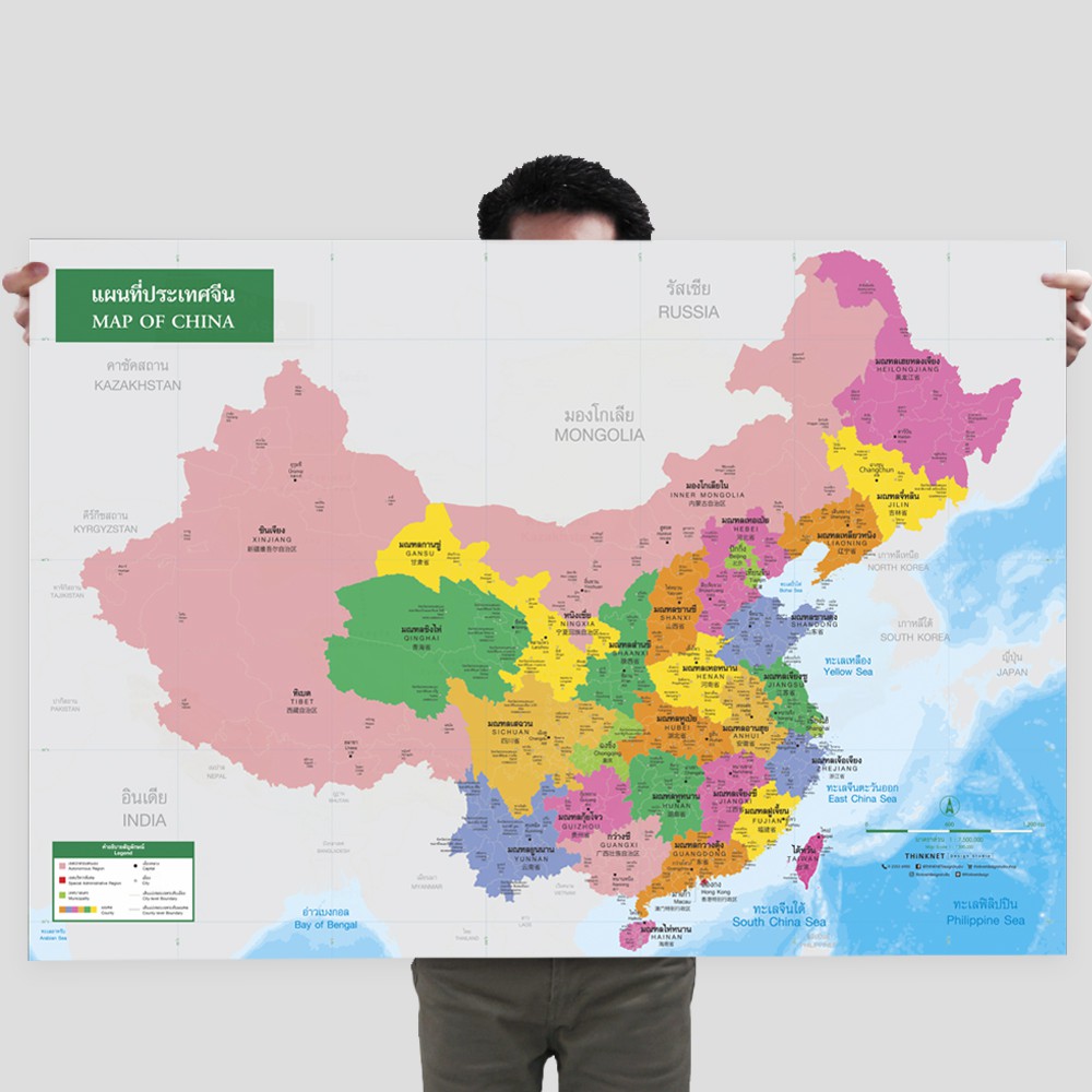
The political map of China shows counties and administrative districts, divided by colors. • There are 23 counties, 5 autonomous regions, 2 special administrative regions, and 4 municipalities, such as Henan, Shandong, Sichuan, Guangdong, and Jiangsu. • Distinct county–level and city–level boundaries. • Shows names, governmental boundaries, and territory borders with neighboring countries such as Mongolia, North Korea, South Korea, Japan, and India. • Shows capital city and major cities. • Shows gulfs and seas. • Trilingual: Thai, English, and Chinese. • 2021 updated.
Published Date : 10/2024
Publisher : Thinknet Design Studio
Category :
900 History & Geography
Page : 1 Pages
245 - Title statement